Lakeside Oasis RV Park: A website you can explore, with a park map you can actually use.
Lakeside Oasis RV Park, known to its guests as LORV Park, has 51 full-hookup concrete sites on a hill above Lake Cumberland in Albany, Kentucky. The redesign gives the park large photography, a clear teal-and-orange identity, plain rates, and an interactive map that lets a guest find their site before they arrive.
Or call (502) 387-1142Or text (502) 387-1142Lakeside Oasis RV Park (LORV Park)
Albany, Kentucky, on Lake Cumberland
Full website redesign and an interactive park map with 51 selectable sites
WordPress, redesign live September 2026
Help people picture the place. Then help them pick their spot.
Lakeside Oasis has a story that is easier to see than to read: the lake, the marina a mile down the road, the hill the park sits on, and the individual sites where guests will spend a night or a season. The redesign brings those pieces together with large photography, a consistent teal-and-orange palette, clear typography and a more useful way to explore the property.
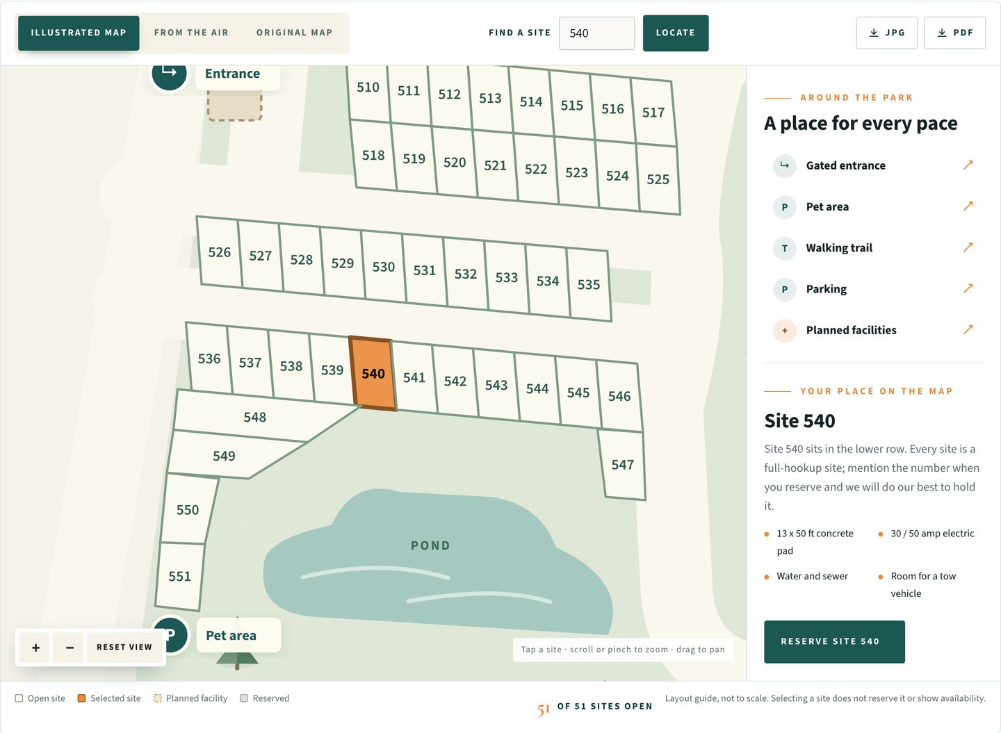
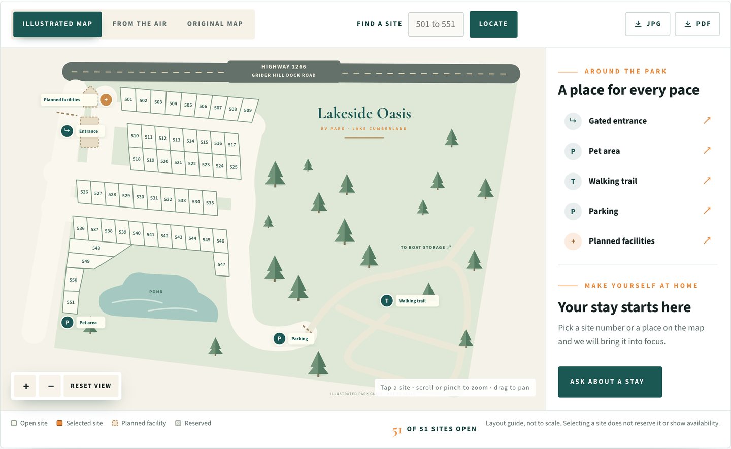
The centerpiece is the park map. The original reference drawing is still there, but visitors can now explore an illustrated version with all 51 sites, numbered 501 through 551. Type a site number, bring it into focus, see where it sits, and carry that number straight into the reservation inquiry.
Selecting a site is not a reservation and the map says so. The park still confirms the stay. What the map does is let a guest arrive at that conversation already knowing where they want to be.
Exact screens, not mockups.
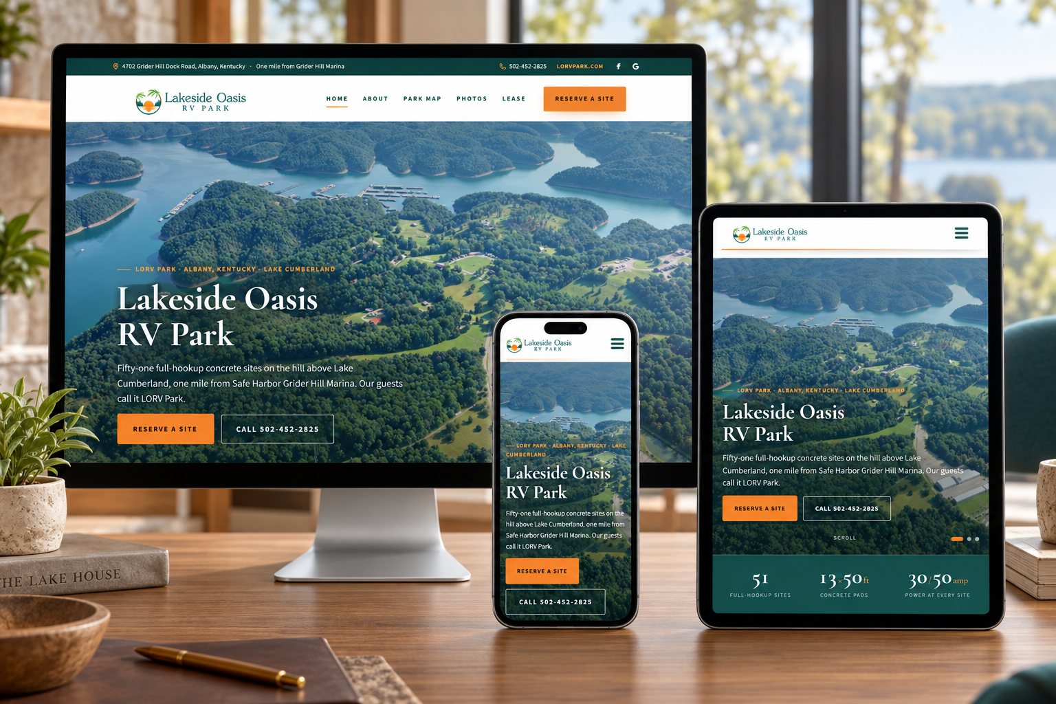
These are direct browser captures of the live site at 1440 and 390 pixels. Nothing redrawn, nothing staged.

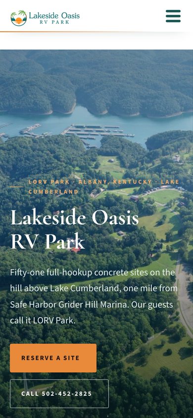
The work, piece by piece.
An interactive park map
Fifty-one selectable sites drawn from the park’s reference map, with search, zoom and pan, keyboard selection, and a highlighted selected site with its details alongside.
Three views of the same ground
The illustrated map, the aerial photograph and the original drawing, one tap apart, plus JPG and PDF downloads for the trip.
Amenity and trail focus
The gated entrance, the pet area, the parking and the walking trail can each be brought into focus, and planned facilities are marked as planned, not open.
A reservation inquiry that knows the site
Selecting site 540 exposes a link that carries that number into the Reserve a Site form, along with length of stay, dates, rig type and length, and whether a pet is coming.
Rates and lease, plainly
Nightly, monthly, seasonal and yearly stays with what is included, what is billed separately, and the lease PDFs to read before check-in.
Photos and a video tour
Aerial and ground photography in the slider and galleries, and a six-minute video tour of the park, shot by the owners in summer 2026, on the homepage.
Built for every screen it will meet.
51
selectable sites, numbered 501 through 551
3
map views: illustrated, from the air, and the original
2
downloads for the trip: JPG and PDF
1
tap from a selected site to the reservation inquiry
An invitation to explore, not a brochure to scroll past.
A property website should help people picture the place and understand their next step. For Lakeside Oasis that means pairing a considered visual redesign with a map visitors can actually use, on a desk and on a phone at the marina.
The map shows the sites the office has marked as reserved, and nothing more. It does not sync with a booking system, it does not take payment, and it does not promise availability. Bookings, traffic and occupancy are not measured outcomes of this project, and this page does not claim them.
Find your place at the park before you get there.
Fifty-one sites, one map, and a reservation inquiry that already knows which one you picked.
Six decisions that shaped the site.
The reference map became an interactive one.
The park had a drawn map: rows of numbered pads, the pond, the entrance. I redrew it as a vector illustration where every one of the 51 sites is a selectable object with its number, its row and its position, so the map can answer a question instead of just showing a picture.
It is a layout guide, not to scale, and the map says so in the corner where a guest would look for the fine print.
Site 540, highlighted, with its details alongside.
Tap a site, or type its number and press Locate, and it fills in orange with a short description in the side panel: where it sits, and that every site is a full-hookup site with a 13 by 50 foot concrete pad, 30 and 50 amp power, water and sewer, and room for a tow vehicle.
Under the details is a button that carries that site number into the reservation inquiry. The office still confirms the site, and the map says selecting one does not reserve it.

Amenities and the trail, brought into focus.
Gated entrance, pet area, parking, planned facilities and the wooded walking trail each have a control that pans the map to them and highlights them. Planned facilities are drawn with a dashed outline and labeled as planned, so the map stays useful without suggesting the bathhouse is open before it is.
The illustration, the aerial and the original.
Some guests want the drawing. Some want to see the real trees and the real pond. The map offers both, plus the original reference drawing, one tap apart, and JPG and PDF downloads so the map can ride along in the truck with no signal.

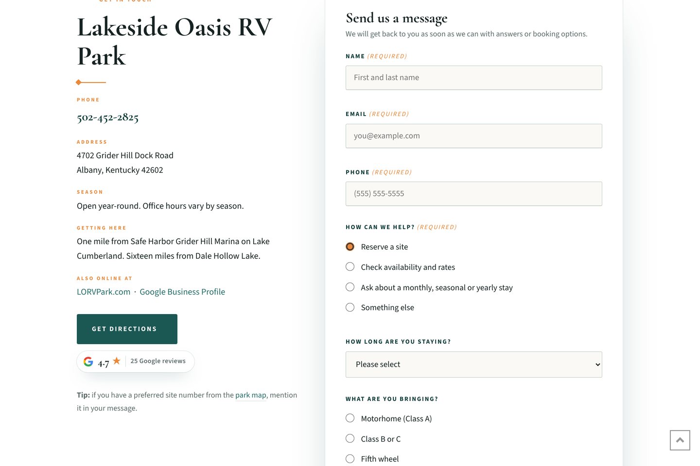
A form that asks what the office needs to answer.
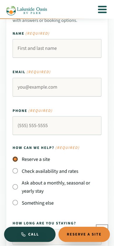
Reserve a Site starts with how the park can help, then asks the length of stay, the dates, what you are bringing and how long it is, a preferred site number if you have one, and whether a pet is coming. When a guest arrives from the map, the site number is already filled in.
Overnight guests use a small group of sites, and the form says the office may suggest another. No payment, no instant booking, no promises the office has not made.
Simple terms, clear pricing, the lease before you arrive.
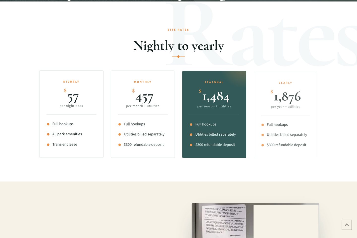
Nightly, monthly, seasonal and yearly stays on one page, with what every site includes, what is billed separately, the deposit, and both lease PDFs to read before check-in takes five minutes.
The map at the marina, in a hand.
The map and every page were checked at 1440, 834 and 390 pixels: 51 sites present, selection and search working, keyboard selection, trail highlight, no sideways scroll and no script errors.

What this project used.
Campground and RV park website design
The service page this project became the example for: what a park website has to do, and how I build it.
Does your campground need an interactive park map?
When a PDF is enough, when it is not, and what an interactive map has to do honestly. Written from this build.
Lakeside Boat Storage
The same family’s boat and RV storage facility next door, with its own refreshed website.
Built in Louisville, for the lake.
Shaun Wilson Designs builds for businesses across Kentucky from a studio in Louisville. Lakeside Oasis is a two-and-a-half hour drive south, one mile from Safe Harbor Grider Hill Marina and sixteen from Dale Hollow Lake. See the areas we serve and the small business website design approach behind this build. The device scenes on this page are presentation environments built from the real screens; the browser captures are the exact record.
Tell me what you are building.
One conversation, one builder, a clear next step. The person you brief is the person who does the work.