
Precision data, captured from above.
High-resolution 2D orthomosaic maps, 3D models, and aerial site documentation for construction, engineering, and land development. Fast, repeatable drone data capture for planning, measurement, and progress tracking.
Or call (502) 387-1142Or text (502) 387-1142See every detail. Measure everything.
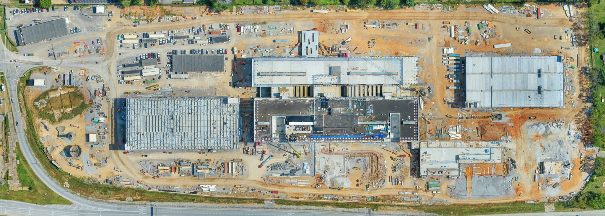
2D orthomosaic maps
High-accuracy top-down maps stitched from hundreds of overlapping images, detailed enough to measure and plan from.
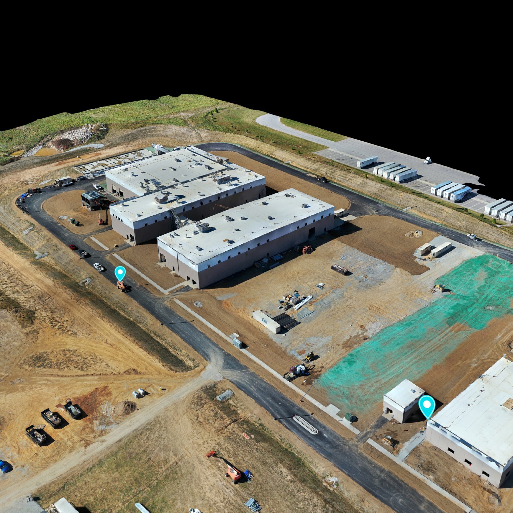
3D models and topography
Photogrammetry models and topographic data that show elevations, stockpiles, and terrain the way flat drawings never can.
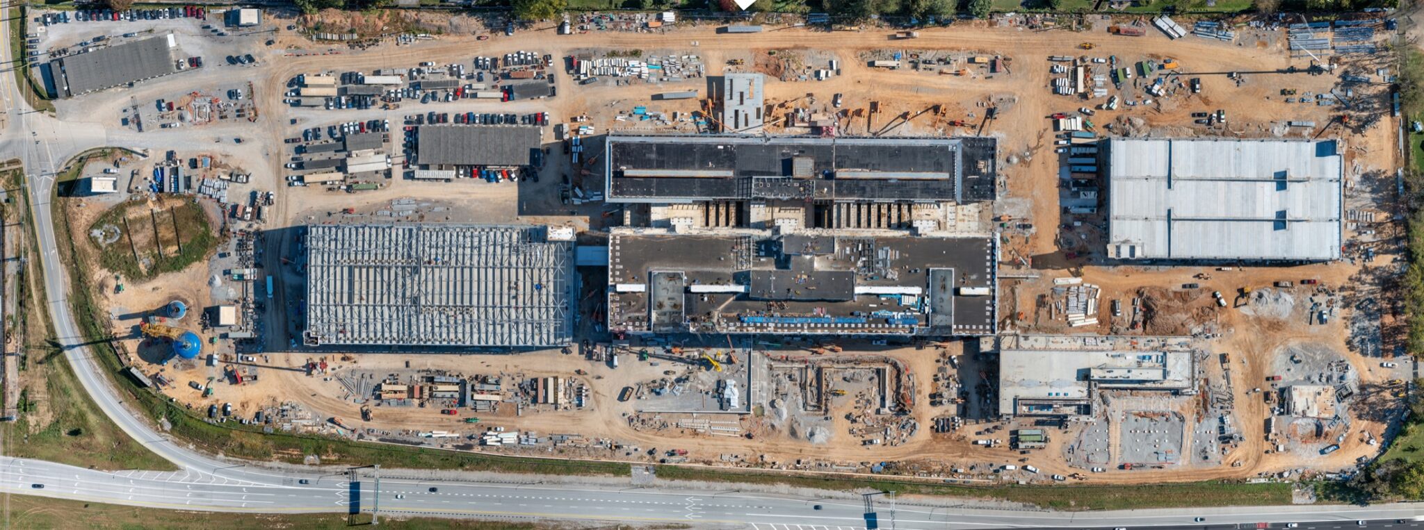
Construction site tracking
Repeat mapping flights document earthwork, utilities, and progress with a measurable record of every phase.
Land development planning
Developers and engineers use my maps to evaluate sites, plan layouts, and communicate with stakeholders clearly.
Fast, repeatable data capture
A drone covers in one flight what takes a ground crew days, at a fraction of the cost and with zero site disruption.
Deliverables that fit your stack
Georeferenced exports ready for your engineering, GIS, and construction management workflows.
Mapping trusted on projects that matter
My repeat mapping flights documented the Louisville VA Medical Center project month after month with orthomosaic maps and wide-area site imagery. With more than 20 years behind the lens and FAA Part 107 certification, I deliver accurate, timely data for projects across Kentucky and Southern Indiana.
From flight grid to finished map
Scope the site
I define the boundary, resolution, and deliverables your project needs before I fly.
Fly the grid
Automated flight paths capture hundreds of overlapping images with consistent accuracy.
Process the data
Images become orthomosaic maps, 3D models, and elevation data through photogrammetry.
Deliver and repeat
Georeferenced deliverables arrive fast, and repeat flights keep the record current.
Before I fly the grid
How accurate are drone maps?
Accuracy depends on flight altitude, overlap, and ground control. I scope each project to hit the resolution your use case actually needs.
What deliverables do I receive?
Orthomosaic maps, 3D models, elevation data, and georeferenced exports, packaged for your engineering or GIS workflow.
How often should a site be re-mapped?
Active construction sites benefit from monthly mapping alongside progress photography. Land evaluation is usually a single flight.
Can you map large or remote sites?
Yes. I primarily serve Kentucky and Southern Indiana and travel for larger projects. Multi-battery automated flights cover large acreage in a single visit.
REAL PROJECT: LOUISVILLE VA MEDICAL CENTER
Two years. One site. Watch it rise.
Monthly orthomosaic maps flown for Walsh Construction on the 40-acre Louisville VA Medical Center project. June 2024 above, July 2026 below.
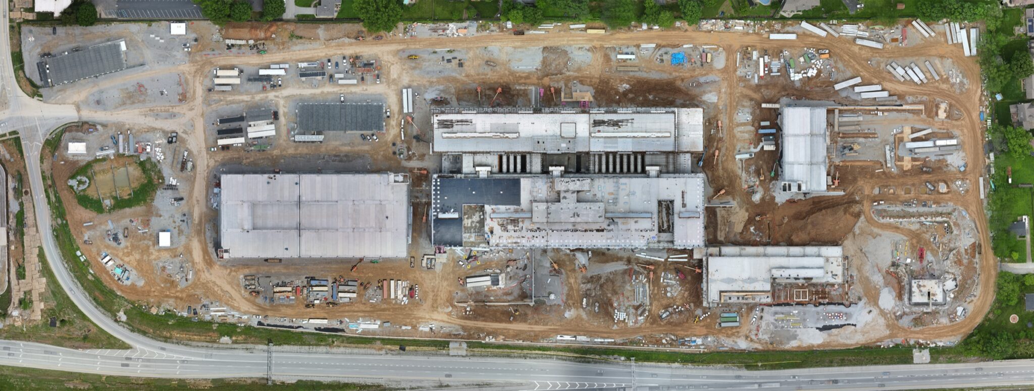
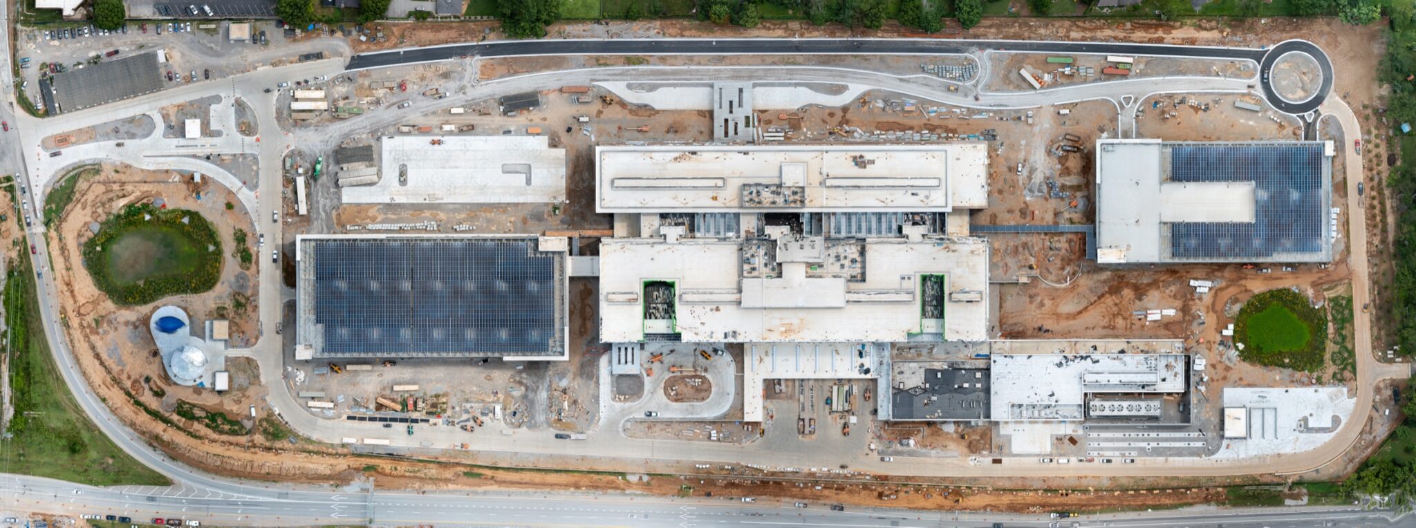
See the full two-year timeline in the VA Medical Center mapping case study.
WHAT LANDS IN YOUR HANDS
Deliverables your team can actually open
A map is worthless if it will not load in the software your engineer already uses. Everything is exported to the formats that drop straight into a normal construction or GIS workflow.
Orthomosaic maps
A single stitched, top-down image of the whole site, geometrically corrected so distances measured on it are real.
Georeferenced exports
GeoTIFF and the common GIS formats, so the map lands in the right place on top of your existing data.
3D models and meshes
Textured models for visualising terrain, stockpiles, and how a structure sits in its surroundings.
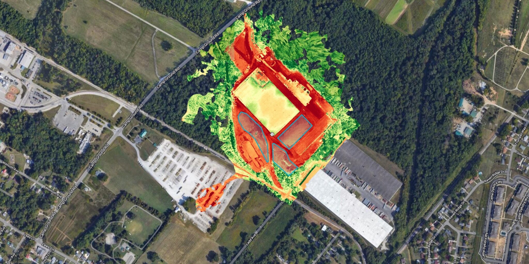
Elevation data
Surface and terrain models for cut and fill, drainage questions, and grade checks between visits.
Point clouds
The raw measured geometry, for teams whose software wants to do its own analysis rather than take mine.
Repeat flights that stack
Fly the same site monthly and the maps align, which turns a set of pictures into a measurable record of change.
Map it once. Know it completely.
Tell me about the site and the decisions you need to make, and I will recommend the right mapping package.
My mapping deliverables are visual planning and documentation tools - orthomosaics, models, and measurements for coordination and progress tracking. They are not boundary or legal land surveys, which must be prepared by a Kentucky licensed professional land surveyor.
Connect With Me